
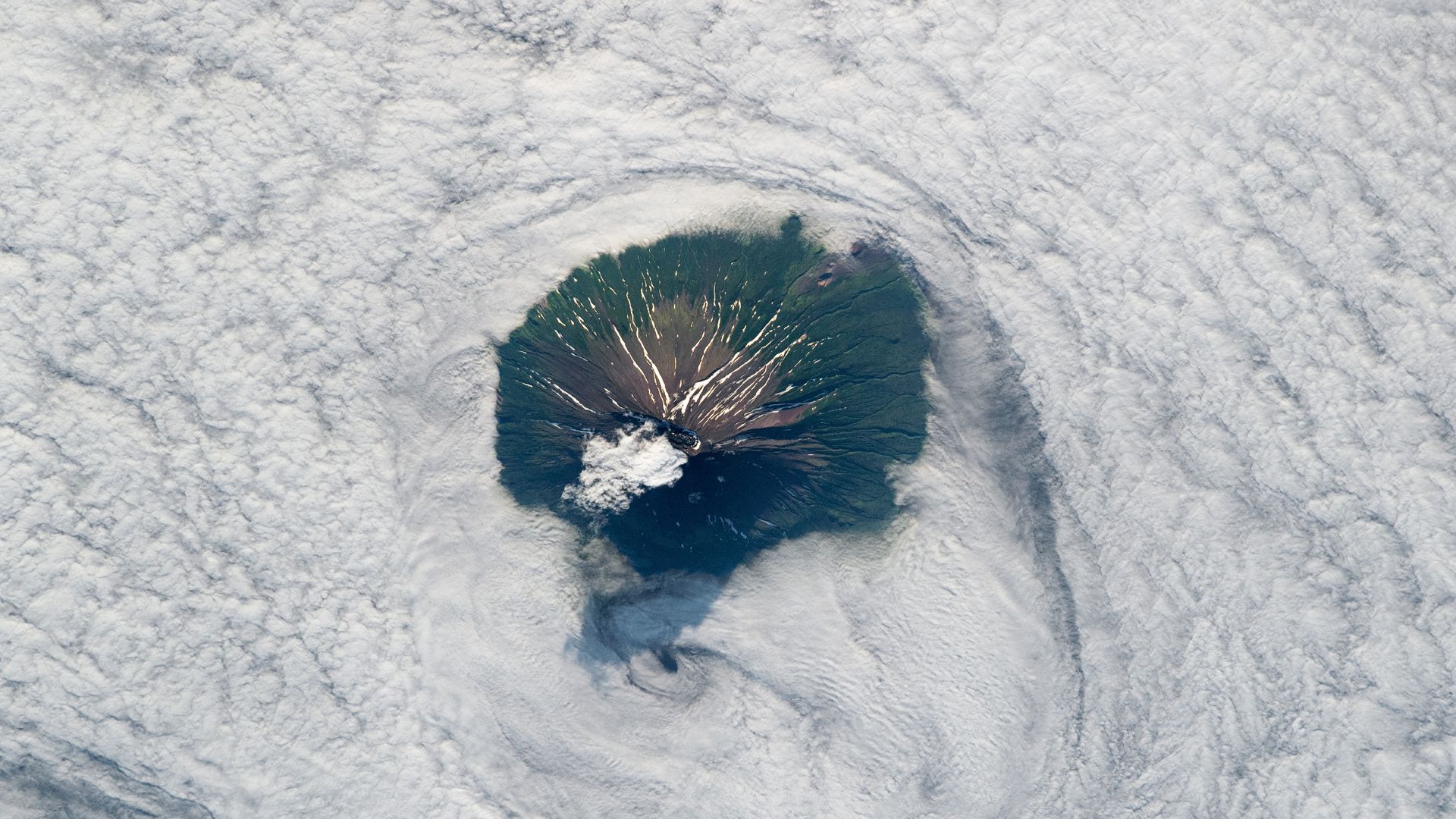
A new astronaut photograph shows the summit of Alaid, a highly active volcano in Russia's Kuril Islands, rising above a cloud bank.
Key facts
- •Alaid is the tallest peak in the Kuril Islands at 7,497 feet (2,285 meters).
- •The volcano is located 40 miles (65 kilometers) from the Kamchatka Peninsula.
- •A major eruption in 1981 ejected a plume of smoke and ash 1,250 miles (2,000 km) long.
- •The volcano's most recent eruption occurred between September and November 2022.
- •A 1972 eruption left a section of the northwest flank barren of vegetation.
An astronaut recently photographed the Alaid volcano on Atlasov Island, the northernmost point of the Kuril Islands chain. The image captures the peak of the volcano, which is known for its near-perfect cone shape, emerging from a thick layer of clouds in the Sea of Okhotsk. Alaid is the tallest peak in the Kuril Islands, reaching 7,497 feet above sea level.
By the numbers
Volcanic Activity and History
Alaid is a highly active volcano that has erupted at least nine times in the last 50 years. A major 1981 eruption produced a 1,250-mile-long plume of smoke and ash, while its most recent activity occurred between September and November 2022, when lava flowed down its snow-covered slopes. The volcano's summit features a caldera approximately one mile wide. Evidence of past eruptions remains visible on the volcano's flanks, including snow-filled gullies and parasitic cones. A 1972 eruption scoured the northwest flank with hot ash, leaving an area devoid of vegetation that, according to a 2009 study, may take hundreds of years to fully recover.
Geological Context
Atlasov Island is located 40 miles off the coast of Russia's Kamchatka Peninsula. The island itself is the exposed summit of a much larger underwater volcano. Over millions of years, lava flows reaching the sea solidified to form the island's base. Geologists believe this larger structure was once connected to the Kamchatka Peninsula by a land bridge that has since been submerged.
Timeline
- 1972A major eruption scoured the volcano's northwest flank with hot ash.
- April 1981A major eruption ejected a 1,250-mile-long plume of smoke and ash.
- 2009A study noted fresh signs of vegetation recovery in the area affected by the 1972 eruption.
- September to November 2022The volcano experienced its most recent eruption, featuring lava flows.
Advertisement
This article was independently rewritten by ManyPress editorial AI from reporting originally published by Live Science.