
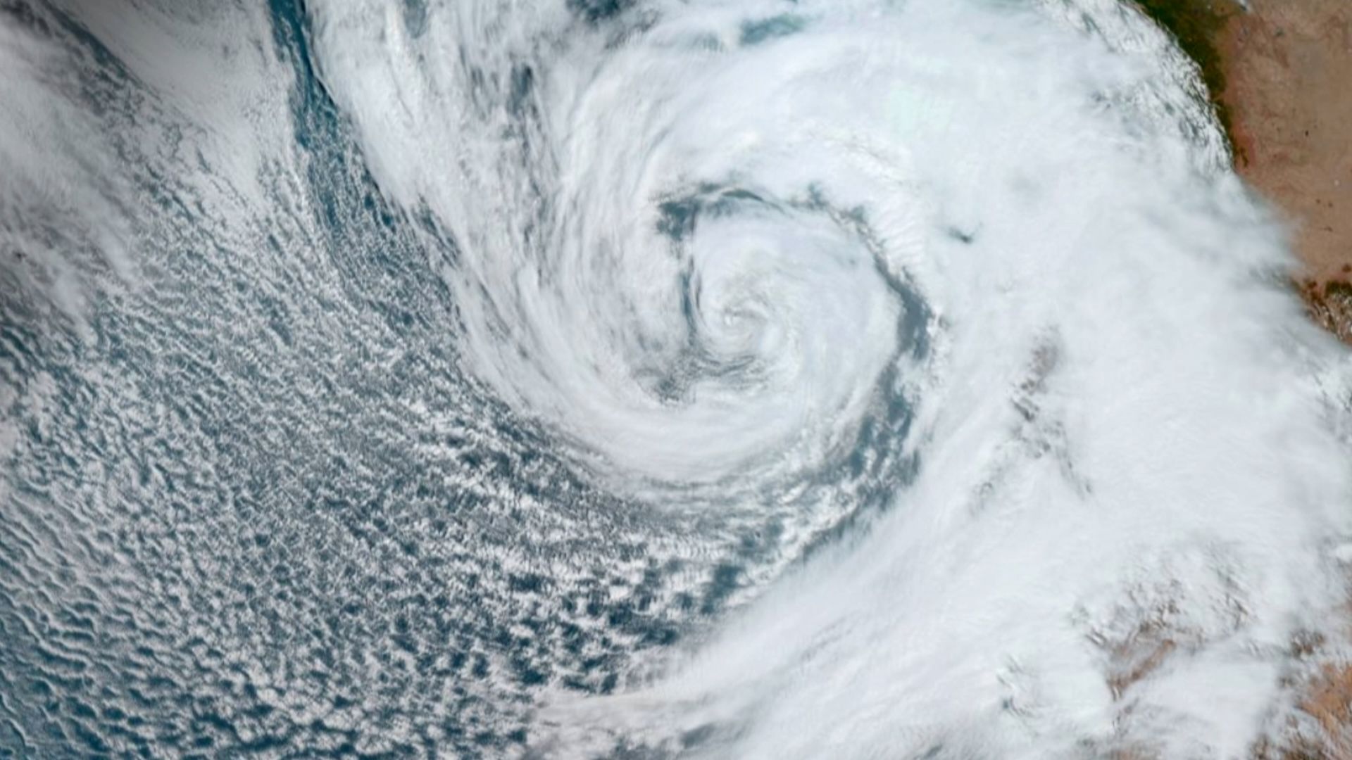
Hurricane Polo has reached Category 4 strength off the coast of Mexico, fueled by exceptionally warm ocean temperatures linked to an El Niño climate pattern.
Key facts
- •Hurricane Polo reached peak wind speeds of 180 mph (290 km/h) during its rapid intensification.
- •The storm was downgraded from Category 5 to Category 4 by Wednesday, September 23.
- •El Niño conditions are officially identified when eastern tropical Pacific waters are at least 0.9 degrees Fahrenheit (0.5 degrees Celsius) above average.
- •The current El Niño event is classified as 'super' because sea surface temperatures have exceeded 2 degrees Celsius above normal levels.
- •The National Hurricane Center warns of life-threatening flooding and mudslides along the Mexican coast.
Hurricane Polo, a powerful Pacific storm, has been downgraded to a Category 4 hurricane after briefly reaching Category 5 status. The storm, which is currently drifting off the southwest coast of Mexico, is not expected to make direct landfall. However, the US National Hurricane Center warns that the system will bring intense wind and torrential rain to the region.
By the numbers
Rapid Intensification and Environmental Factors
Hurricane Polo underwent rapid intensification on Tuesday, September 22, escalating from a tropical storm to a Category 5 hurricane in less than 24 hours. According to Julian Heming, an environmental scientist at the U.K.'s Met Office, such rapid development requires high sea temperatures, low wind shear, and upper-air conditions that allow air to escape the storm's core efficiently.
The Role of El Niño
The storm's strength is attributed to exceptionally warm waters in the eastern tropical Pacific, which have been influenced by a strong El Niño phenomenon present since June. This climate pattern, which occurs every two to seven years, provides the heat and moisture necessary for tropical cyclones to organize and strengthen. While not a formal scientific term, the current event is being described as a 'super' El Niño due to sea surface temperatures rising more than 2 degrees Celsius above normal.
Potential Hazards for Mexico
Although the storm is not projected to hit land, the National Hurricane Center has issued warnings for the southwest coast of Mexico. The system is expected to produce life-threatening flooding and mudslides, alongside hazardous ocean conditions. The Pacific hurricane season, which runs from May through November, continues as the storm moves in a northwest direction.
Advertisement
This article was independently rewritten by ManyPress editorial AI from reporting originally published by BBC Science & Environment, Live Science.